A powerful El Niño is steering a wetter winter toward California, raising real hopes for deeper Sierra snow.
Story Highlights
- Federal forecasters expect a wetter-than-average winter across much of California.
- El Niño is likely to stay strong through the core ski months of December to February.
- Snow gains depend on storm tracks and snow levels, favoring higher elevations.
- Bigger Sierra snowpacks can boost local jobs and winter tourism revenue.
NOAA maps point to a wetter California winter
The National Oceanic and Atmospheric Administration’s winter outlook places California inside a broad band of wetter-than-average conditions for December 2026 through February 2027. The agency ties this pattern to El Niño’s classic storm track that feeds Pacific systems into the southern tier of the United States. For skiers, more moisture means more chances for storms. Resorts in the Sierra Nevada often see the payoff when those storms arrive cold enough to lay down snow rather than rain.
The Climate Prediction Center within the National Weather Service reports that El Niño continues to strengthen and is likely to remain strong to very strong through January to March 2027. That timing covers the heart of California’s ski season, when repeated storms can build a base and keep trails refreshed. A stable El Niño signal improves odds for frequent systems, which can translate to steady snow at higher peaks where temperatures stay below freezing more often.
Elevation and storm track will decide winners and losers
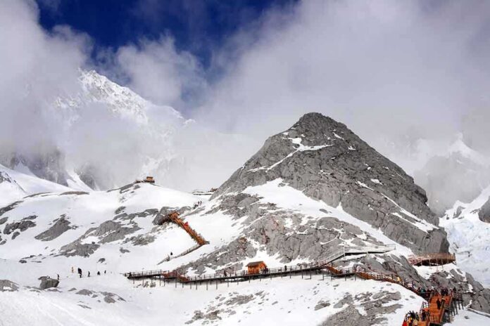
Scientists and mountain operators caution that snowfall is not just about moisture; it is about temperature and elevation. Research shows higher elevations tend to gain more snow during strong El Niño years, while lower slopes can see more rain if snow levels sit high. Storm tracks that tap subtropical moisture can be warm, which can lift the rain-snow line. Resorts with summit terrain above typical snow levels stand to benefit most when these storms roll through.
History backs the “high ground advantage.” The Central Sierra recorded massive totals during the 1982–83 and 1997–98 El Niño winters, when cold phases of repeated storms coincided with strong moisture. That mix produced huge seasonal sums in the upper Sierra. Still, past years also show uneven results at lower elevations in the same winters. This spread underscores a key point for skiers: chase elevation, not just the forecast headline, when planning key trips around major storm windows.
Economic upside for mountain towns if snow stacks up
California’s ski economy supports tens of thousands of jobs in a normal snow year, and it gains when storms hit often and cold. Visitor numbers rise when base depths grow and roads stay open. Local shops, rentals, and family-run lodges see more business, and seasonal workers get steadier hours. Consistent snowfall also helps resorts stagger openings across terrain, which spreads crowds and improves safety and service for guests during peak holiday periods.
Storm type also matters for operations and water supply. Pacific “atmospheric river” events can be warmer, yet they deliver a large share of the Sierra’s seasonal snow when snow levels drop during or after the core of the event. When cold air follows a wet plume, totals can jump fast across high basins. These cycles build snowpack that supports spring runoff and hydropower, which can ease energy costs for families when reservoirs and dams receive a healthy recharge.
How to plan your season around the El Niño signal
Skiers should watch freezing levels before each storm and favor resorts with terrain above the forecast snow line. Travel midweek when a cold system is due, and build flexibility into plans so you can pivot north or higher if a warm plume lifts snow levels. Families should lock in refundable lodging and target windows when back-to-back storms are likely, which El Niño can deliver. This simple strategy turns a broad climate signal into real days on fresh snow instead of rain.
One caveat applies: seasonal outlooks set odds, not guarantees. Local snowfall still depends on where each storm hits and how cold it gets. That said, this winter’s setup stacks the deck for more frequent storms across California, with the best chances for stronger snow at higher elevations in the Sierra Nevada. If you value time outside with your family, watch the forecast, aim high, and be ready to move when the pattern opens the door.
Sources:
nypost.com, cpc.ncep.noaa.gov, usatoday.com, usgs.gov, sfchronicle.com, mercedsunstar.com